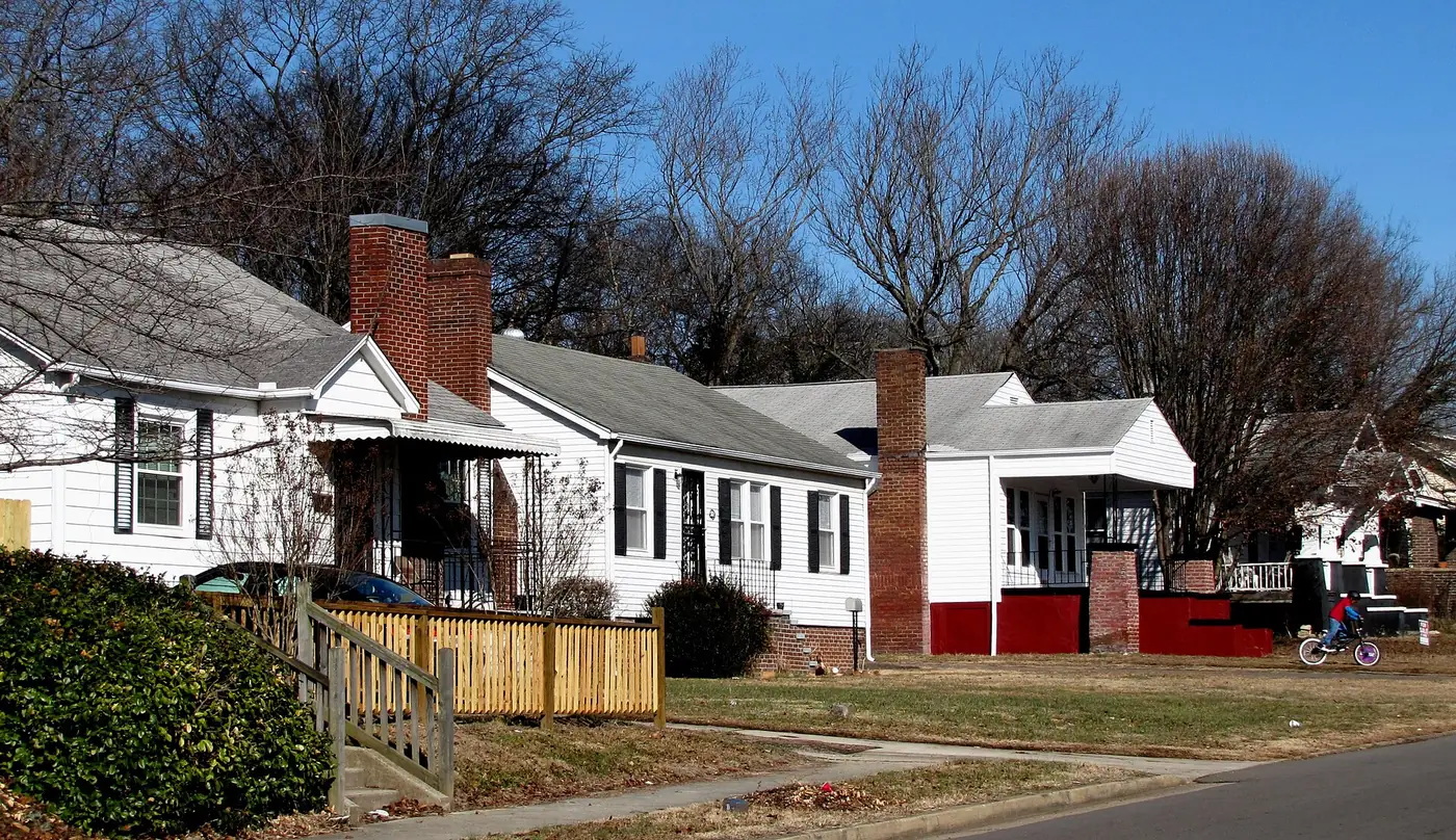
Eleven Knoxville neighborhoods, from downtown and Fort Sanders to Fountain City and West Hills, with zoned high schools, ZIP codes and Zillow home values.
Last checked Oct. 17, 2026. Sources: KGIS (Knoxville-Knox County-KUB Geographic Information System) KGIS Maps: its “Neighborhoods in Knox County” boundaries, neighborhood groups, city limits, ZIP codes, historic districts and Knox County Schools attendance zones; the Tennessee Department of Education’s 2024-25 letter grades; Zillow Research; the Census Bureau’s QuickFacts; and OpenStreetMap.
Knoxville is a city of about 195,000 people in Knox County, on the north bank of the Tennessee River. Interstate 40 crosses it east to west, joined by I-75 on the west side; I-640 loops around the north side and I-275 runs north from downtown. Kingston Pike leads west through Sequoyah Hills, Bearden and West Hills, Broadway north to Fountain City, and Chapman Highway south across the river. Alcoa Highway (U.S. 129) heads south to McGhee Tyson Airport.
The city limit is irregular, and a Knoxville mailing address does not mean a home is inside it. By land area, about three-quarters of ZIP codes 37914, 37918 and 37920 lies outside the city, according to KGIS’s ZIP code and city limits maps, and so does about two-thirds of the Cedar Bluff area. Homes inside the city pay both the Knox County and City of Knoxville property taxes; see our property taxes guide.
Knox County Schools runs the public schools for the city and the county, and its attendance zones do not follow the city limit. South Knoxville is zoned for South-Doyle High and most of Holston Hills for Carter High, both outside the city. Several neighborhoods are split between two high schools.
What this means for you
- Check the address, not the neighborhood. Use the KGIS school zone search for schools and the city limits layer on KGIS Maps for whether a parcel is inside Knoxville.
- Home values: $368,965 for the city in September 2026, and $251,452 to $642,347 across the ZIP codes in this guide, according to the Zillow Home Value Index.
- High schools: the 11 areas are zoned for Austin-East, Bearden, Carter, Central, Fulton, South-Doyle and West high schools.
The areas at a glance
| Area | ZIP | Zoned high school | Typical home value in its ZIP, September 2026 | Guide |
|---|---|---|---|---|
| Downtown | 37902 | Austin-East (most); West (west edge) | $642,347 | Downtown |
| Fort Sanders | 37916 | West | $500,826 | Fort Sanders |
| Mechanicsville | 37921 | Fulton (east); West (west) | $288,261 | Mechanicsville |
| Fourth and Gill and Old North Knoxville | 37917 | Fulton | $251,452 | Fourth and Gill and Old North |
| Parkridge | 37917, 37914 | Austin-East | $251,452; $251,747 | Parkridge |
| Holston Hills | 37914 | Carter (most); Austin-East (west) | $251,747 | Holston Hills |
| Fountain City | 37918 | Central | $330,617 | Fountain City |
| South Knoxville | 37920 | South-Doyle | $318,290 | South Knoxville |
| Sequoyah Hills | 37919 | West | $546,304 | Sequoyah Hills |
| Bearden | 37919 | West | $546,304 | Bearden |
| West Hills | 37909 | Bearden (west); West (east) | $376,931 | West Hills |
Home values are the Zillow Home Value Index for the ZIP code, a modeled typical value for the middle third of homes, not a sale price. ZIP codes are much larger than these neighborhoods and several share one, so the figure does not describe any one area. On the 2024-25 state report card, Bearden and West high schools were graded A, Carter and Central B, Austin-East and South-Doyle C, and Fulton D.
Map
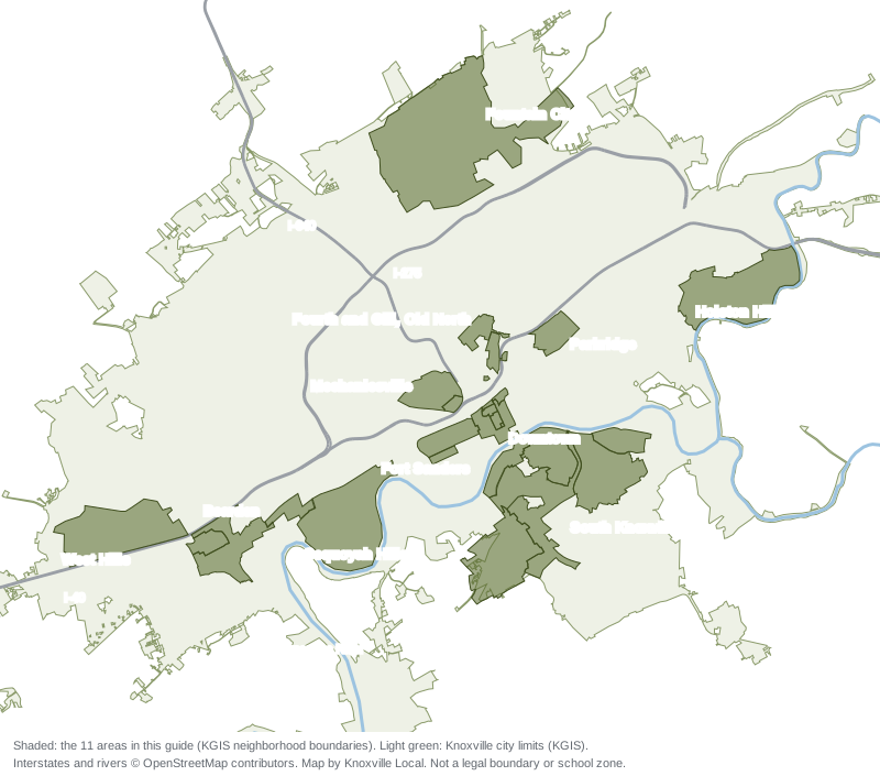
Map by Knoxville Local from KGIS’s “Neighborhoods in Knox County” and city limits layers on KGIS Maps. Interstates and rivers © OpenStreetMap contributors. Shaded areas are KGIS neighborhood boundaries, not legal boundaries or school zones.
Downtown
The business and government center on the river, with apartments and condominiums around Gay Street, Market Square and the Old City; five National Register districts. ZIP 37902. Read the downtown guide.
Fort Sanders
The historic district between downtown and the University of Tennessee, with two hospitals on Clinch Avenue and KAT Route 42. Zoned for West High. Read the Fort Sanders guide.
Mechanicsville
Northwest of downtown between Western Avenue and University Avenue, home to the Knoxville College campus and Malcolm-Martin Park; split between Fulton and West High. Read the Mechanicsville guide.
Fourth and Gill and Old North Knoxville
Two neighboring historic districts north of downtown, nearly all under the city’s historic overlay, zoned mostly for Fulton High. Read the Fourth and Gill and Old North guide.
Parkridge
East of downtown along North Cherry Street, inside the Park City Historic District and zoned for Austin-East High. Read the Parkridge guide.
Holston Hills
Wooded streets above the Holston River in East Knoxville, a National Register district named for its country club and homes; mostly Carter High. Read the Holston Hills guide.
Fountain City
The large North Knoxville community along North Broadway, with Fountain City Park and its lake and Adair Park; zoned for Central High. Read the Fountain City guide.
South Knoxville
Island Home, Old Sevier, South Haven, the South Waterfront and Vestal, across the river from downtown, with the Urban Wilderness trails and Ijams Nature Center; South-Doyle High. Read the South Knoxville guide.
Sequoyah Hills
Riverside streets south of Kingston Pike along Cherokee Boulevard and its median greenway, most of it a National Register district; zoned for West High. Read the Sequoyah Hills guide.
Bearden
The Kingston Pike area around Papermill and Northshore drives, with supermarkets on the pike and the Third Creek Greenway; zoned for West High, not Bearden High. Read the Bearden guide.
West Hills
Residential streets north of I-40 around 45-acre West Hills Park, split between Bearden High and West High. Read the West Hills guide.
Knoxville in numbers
From the Census Bureau’s 2020-2024 American Community Survey five-year estimates for the City of Knoxville, on QuickFacts:
| Measure | Knoxville |
|---|---|
| Population | 195,185 |
| Median household income | $54,039 |
| Median value of owner-occupied homes | $239,700 |
| Homes that are owner-occupied | 46.6% |
| Mean travel time to work | 20.2 minutes |
These are survey estimates with margins of error. To see how Knoxville compares with Alcoa, Clinton and Farragut on taxes, schools and home values, read Knoxville vs Alcoa vs Clinton vs Farragut.
How we built this
The 11 areas come from KGIS, the mapping agency shared by Knoxville, Knox County and the Knoxville Utilities Board. Its “Neighborhoods in Knox County” layer on KGIS Maps names and draws 229 neighborhoods; we used its boundaries for every area, combining neighbors where KGIS splits one place into parts (downtown’s districts; South Knoxville’s riverside neighborhoods; Bearden, Bearden Village and Bearden Hill). We checked each name against OpenStreetMap’s place names and KGIS’s map of the city’s registered neighborhood groups, and chose areas spread across the city’s north, south, east and west. We name no subdivision unless KGIS or OpenStreetMap names it as a place.
School zones come from the Knox County Schools attendance zone layers on KGIS Maps; grades from the state’s 2024-25 letter grade file; ZIP codes, city limits, historic districts and overlays from KGIS; home values from Zillow’s ZIP and city files; parks from Knoxville-Knox County Planning’s parks layer; bus stops from KAT stop data published by Knoxville-Knox County Planning; and distances from the OSRM routing engine on OpenStreetMap roads. All were checked Oct. 17, 2026.
More guides: home prices, schools, property taxes, moving to Knoxville, getting around and parks and trails.
Frequently asked questions
What are the neighborhoods in Knoxville, Tennessee?
KGIS, the city and county mapping agency, names more than 200 neighborhoods in Knox County. This guide covers 11 inside the city: Downtown, Fort Sanders, Mechanicsville, Fourth and Gill and Old North Knoxville, Parkridge, Holston Hills, Fountain City, South Knoxville, Sequoyah Hills, Bearden and West Hills.
Does a Knoxville address mean a home is inside the city?
No. Mailing addresses and ZIP codes reach well beyond the city limits into unincorporated Knox County. KGIS’s map shows, for example, that about two-thirds of the Cedar Bluff area is outside the city. Homes inside the city pay both city and county property taxes.
Which high school will my Knoxville home be zoned for?
Knox County Schools runs every public school in the city, and zones do not follow city or neighborhood lines. The areas in this guide are zoned for seven high schools, and several are split between two, so check the address in the KGIS school zone search.
What is the typical home value in Knoxville?
$368,965 in September 2026, up 1.0% in a year, according to the Zillow Home Value Index, a modeled value for the middle third of homes, not a sale price. By ZIP code it ran from $251,452 in 37917 to $642,347 in 37902.
Have your say