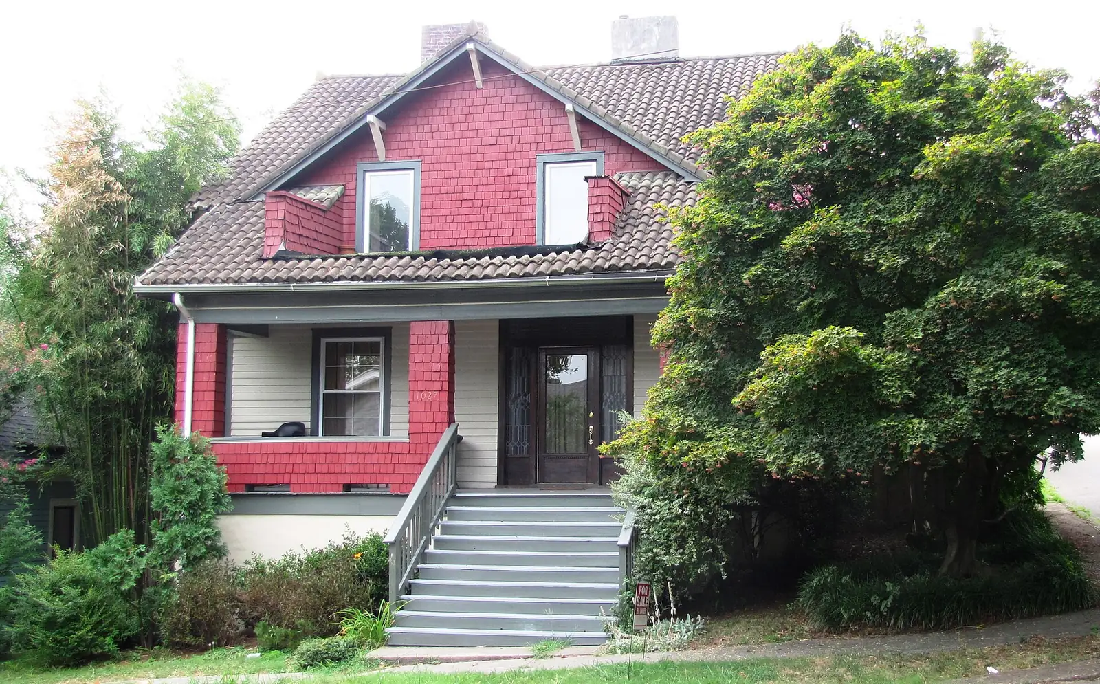
Fourth and Gill and Old North Knoxville are historic districts zoned mostly for Fulton High. Zillow put ZIP 37917 at $251,452 in September 2026.
Last checked Oct. 17, 2026. Sources: KGIS’s KGIS Maps (the “Neighborhoods in Knox County” boundaries, neighborhood groups, Knox County Schools attendance zones, ZIP codes, historic districts and zoning overlays); the Tennessee Department of Education’s 2024-25 letter grades; Zillow Research; Knoxville Area Transit; and OpenStreetMap.
Fourth and Gill and Old North Knoxville are two neighboring historic districts of older houses just north of downtown, on either side of the streets between North Broadway and North Central Street. Each has its own neighborhood association, and nearly all of both is under the city’s historic zoning overlay.
What this means for you
- Zoned high school: Fulton High for nearly all of both neighborhoods (graded D for 2024-25).
- Home value: $251,452 in ZIP code 37917 in September 2026, according to the Zillow Home Value Index.
- Nearest interstate exits: I-40 exit 389 (U.S. 441, Broadway and Hall of Fame Drive) and I-275 exit 1A (Baxter Avenue), each about 1 mile by road.
Part of our Knoxville neighborhoods guide.
Where it is
This guide follows KGIS’s “Neighborhoods in Knox County” boundaries for Fourth & Gill and Old North Knoxville, about 0.35 square miles together, all inside the city and all in ZIP code 37917. Fourth and Gill is the southern of the two, around North 4th Avenue, Gill Avenue, Eleanor Street, Luttrell Street and Gratz Street. Old North Knoxville is to its north, around Glenwood Avenue, Armstrong Avenue, Kenyon Street, East Oklahoma Avenue and Scott Avenue. North Broadway (U.S. 441) and Hall of Fame Drive run along the east side.
KGIS maps the Fourth and Gill Historic District and the Old North Knoxville Historic District, both on the National Register, over the two neighborhoods, and the city’s historic (H) overlay over nearly all of them. New buildings, additions and exterior changes there go through the city’s Historic Zoning Commission; see our building permits and zoning guide.
Schools
From the Knox County Schools attendance zones on KGIS Maps, checked Oct. 17, 2026. Grades are each school’s overall grade on Tennessee’s 2024-25 state report card:
| Level | School | Address | 2024-25 grade | Where it is zoned |
|---|---|---|---|---|
| Elementary | Christenberry Elementary | 927 Oglewood Ave. | B | The northern part, mostly Old North |
| Elementary | Beaumont Elementary Magnet | 1211 Beaumont Ave. | B | The southern part, mostly Fourth and Gill |
| Middle | Whittle Springs Middle | 2700 White Oak Lane | B | About four-fifths, the north and center |
| Middle | Vine Middle Magnet | 1807 Martin Luther King Jr. Ave. | D | The southern edge |
| High | Fulton High | 2509 N. Broadway | D | Nearly all |
| High | Austin-East High Magnet | 2800 Martin Luther King Jr. Ave. | C | A few blocks in the southeast corner |
The lines split these neighborhoods, so check the exact address in the KGIS school zone search. More in our schools guide.
Home values
The typical home value in ZIP code 37917 was $251,452 in September 2026, down 3.2% from $259,825 in September 2025, according to the Zillow Home Value Index. The index is a modeled typical value for the middle third of homes, not a sale price, and 37917 reaches well beyond these two neighborhoods into North and East Knoxville. The City of Knoxville figure was $368,965, up 1.0%. More in our home prices guide.
Parks and trails
From Knoxville-Knox County Planning’s parks map layer:
- Fourth and Gill Park, 808 Eleanor St., with a short park trail.
- Baxter Avenue Park, 218 E. Baxter Ave.
- Beth Ann Booker Park, 416 E. Oklahoma Ave., in Old North.
- Caswell Park, 1412 Woodbine Ave., a 37-acre park on the east edge.
- First Creek Park, 1240 Cottage Place, along First Creek.
More in our parks and trails guide and walking and biking trails guide.
Getting around
- Interstate: I-40 exit 389 (U.S. 441, Broadway and Hall of Fame Drive) and I-275 exit 1A (Baxter Avenue) are each about 1 mile by road; I-275 exit 1B (Woodland Avenue and Oldham Avenue) is about 1.2 miles.
- Downtown: about 1.8 miles by road to Market Square.
- Airport: about 18.1 miles by road to McGhee Tyson Airport (TYS).
- Bus: KAT Route 24 (Lincoln Park and Inskip) has the most stops here, and Route 22 (Broadway) runs along North Broadway. Stops on the edges also serve Route 15 (Woodland Crosstown) and Route 20 (Central and Clinton Highway), in the KAT stop data published by Knoxville-Knox County Planning.
Distances are measured on the OpenStreetMap road network with the OSRM routing engine; exit distances run from the off-ramp to the middle of the neighborhood. They are distances, not drive times.
Neighborhood groups
KGIS’s neighborhood groups map shows two active neighborhood associations: the Historic Fourth and Gill Neighborhood Association and Old North Knoxville Inc. They are voluntary groups, not homeowners associations with dues on the deed.
Groceries and everyday stores
From OpenStreetMap:
- Three Rivers Market, 1100 N. Central St., at the southwest corner.
- Kroger, 2217 N. Broadway, just north of Old North.
- Walgreens and CVS Pharmacy, both on North Broadway north of the neighborhoods.
How we drew this area
The area combines the KGIS “Neighborhoods in Knox County” polygons for Fourth & Gill and Old North Knoxville. Zones, ZIP codes and overlays come from points sampled across those boundaries, checked Oct. 17, 2026. Store and road data are © OpenStreetMap contributors.
Frequently asked questions
What high school is Fourth and Gill zoned for?
Fulton High School, 2509 N. Broadway, for nearly all of Fourth and Gill and Old North Knoxville, according to KGIS school zone maps. A few blocks in the southeast corner are zoned for Austin-East High Magnet.
Are Fourth and Gill and Old North Knoxville historic districts?
Yes. Both are National Register historic districts, and nearly all of both neighborhoods carries the City of Knoxville’s historic (H) zoning overlay, so exterior changes need a certificate of appropriateness.
What ZIP code is Old North Knoxville in?
ZIP code 37917, like Fourth and Gill. Zillow’s typical home value for 37917 was $251,452 in September 2026, down 3.2% from a year earlier.
Which bus serves Fourth and Gill?
KAT Route 24 (Lincoln Park and Inskip) has the most stops in the two neighborhoods, and Route 22 (Broadway) runs along North Broadway, according to KAT stop data.
Have your say