Parkridge, east of downtown, lies in the Park City Historic District and is zoned for Austin-East High. ZIP 37917: $251,452 in September 2026.
Last checked Oct. 17, 2026. Sources: KGIS’s KGIS Maps (the “Neighborhoods in Knox County” boundaries, neighborhood groups, Knox County Schools attendance zones, ZIP codes, historic districts and zoning overlays); the Tennessee Department of Education’s 2024-25 letter grades; Zillow Research; Knoxville Area Transit; and OpenStreetMap.
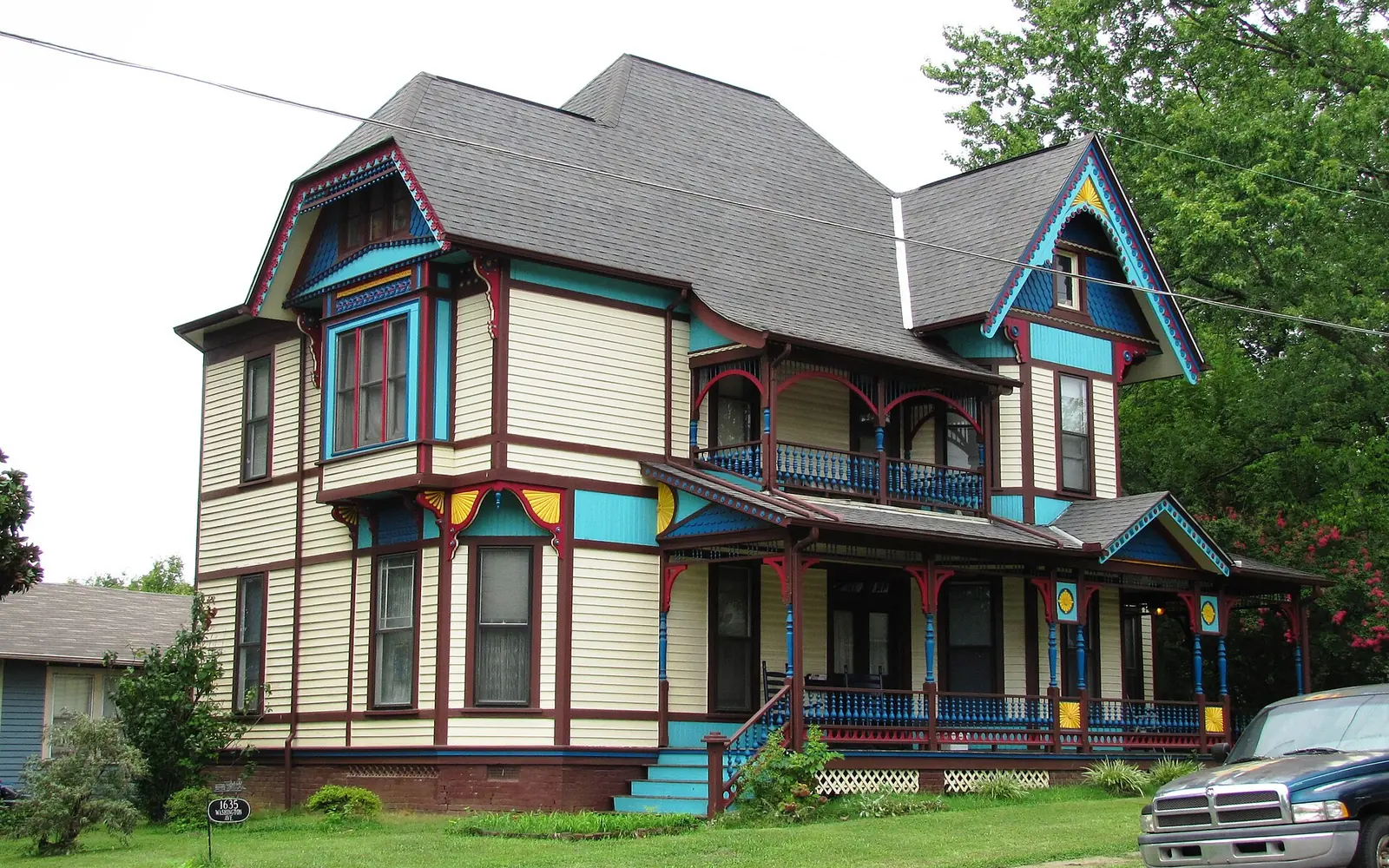
Parkridge is a neighborhood of older houses on a grid of streets east of downtown, along North Cherry Street. Nearly all of it lies in the National Register-listed Park City Historic District, and it is the home of an active neighborhood organization.
What this means for you
- Zoned high school: Austin-East High Magnet for all of Parkridge (graded C for 2024-25).
- Home value: $251,452 in ZIP code 37917 in September 2026, according to the Zillow Home Value Index.
- Nearest interstate exit: I-40 exit 390 (Cherry Street), about 0.9 miles by road.
Part of our Knoxville neighborhoods guide.
Where it is
This guide follows KGIS’s “Neighborhoods in Knox County” boundary for Parkridge, about 0.34 square miles inside the city. North Cherry Street runs north and south through its east side. Its streets include Washington Avenue, Jefferson Avenue, Woodbine Avenue, Glenwood Avenue, Adams Avenue, Spruce Street, North Chestnut Street, Olive Street and Dodson Avenue. About 86% of it is in ZIP code 37917 and the southeast corner in 37914.
The Park City Historic District covers nearly all of Parkridge on KGIS’s historic districts map, and some blocks carry the city’s historic (H) overlay, which adds design review for exterior changes. See our building permits and zoning guide.
Schools
From the Knox County Schools attendance zones on KGIS Maps, checked Oct. 17, 2026. Grades are each school’s overall grade on Tennessee’s 2024-25 state report card:
| Level | School | Address | 2024-25 grade | Where it is zoned |
|---|---|---|---|---|
| Elementary | Belle Morris Elementary | 2308 Washington Pike | D | About half, the north and center |
| Elementary | Sarah Moore Greene Magnet Technology Academy | 3001 Brooks Road | F | About a third, the east |
| Elementary | Christenberry Elementary | 927 Oglewood Ave. | B | The west edge |
| Middle | Vine Middle Magnet | 1807 Martin Luther King Jr. Ave. | D | All |
| High | Austin-East High Magnet | 2800 Martin Luther King Jr. Ave. | C | All |
The elementary lines split the neighborhood, so check the exact address in the KGIS school zone search. More in our schools guide.
Home values
The typical home value in ZIP code 37917 was $251,452 in September 2026, down 3.2% from $259,825 in September 2025, according to the Zillow Home Value Index. In 37914 it was $251,747, down 0.6%. The index is a modeled typical value for the middle third of homes, not a sale price, and both ZIP codes reach far beyond Parkridge. The City of Knoxville figure was $368,965, up 1.0%. More in our home prices guide.
Parks and trails
From Knoxville-Knox County Planning’s parks map layer:
- Parkridge Park, 1901 Briscoe Ave., inside the neighborhood.
- Caswell Park, 1412 Woodbine Ave., a 37-acre park just west.
- William Powell Park, 1900 Linden Ave., and the Ashley Nicole Dream Playground, 620 Winona St., nearby.
- First Creek Park, 1240 Cottage Place, to the northwest.
More in our parks and trails guide.
Getting around
- Interstate: I-40 exit 390 (Cherry Street) is about 0.9 miles by road; exit 389 (U.S. 441, Broadway and Hall of Fame Drive) is about 2 miles.
- Downtown: about 2.6 miles by road to Market Square.
- Airport: about 19.1 miles by road to McGhee Tyson Airport (TYS).
- Bus: KAT Route 31 (Magnolia) has stops in the neighborhood, in the KAT stop data published by Knoxville-Knox County Planning. KAT lists a long-term detour on Route 31; see our getting around guide.
Distances are measured on the OpenStreetMap road network with the OSRM routing engine; exit distances run from the off-ramp to the middle of the neighborhood. They are distances, not drive times.
Neighborhood groups
KGIS’s neighborhood groups map shows the Parkridge Community Organization, an active neighborhood association, covering the whole area. It is a voluntary group, not a homeowners association with dues on the deed.
Groceries and everyday stores
OpenStreetMap shows no supermarket or pharmacy inside Parkridge or within about half a mile of it. The nearest it maps are Kroger, 2217 N. Broadway, and Three Rivers Market, 1100 N. Central St., both to the west.
How we drew this area
The area is the KGIS “Neighborhoods in Knox County” polygon for Parkridge. Zones, ZIP codes and overlays come from points sampled across that boundary, checked Oct. 17, 2026. Store and road data are © OpenStreetMap contributors.
Frequently asked questions
What high school is Parkridge zoned for?
All of Parkridge is zoned for Austin-East High Magnet, 2800 Martin Luther King Jr. Ave., and Vine Middle Magnet, according to KGIS school zone maps. Elementary zones are split among Belle Morris, Sarah Moore Greene Magnet and Christenberry.
What ZIP code is Parkridge in?
Most of Parkridge is in ZIP code 37917; the southeast corner is in 37914. Zillow put the typical home value at $251,452 in 37917 and $251,747 in 37914 in September 2026.
Is Parkridge a historic district?
Yes. KGIS maps the National Register-listed Park City Historic District over nearly all of Parkridge, and some blocks carry the city’s historic (H) zoning overlay.
Which bus serves Parkridge?
KAT Route 31 (Magnolia) has stops in the neighborhood, according to KAT stop data. KAT lists a long-term detour on Route 31; check katbus.com before you ride.
Have your say